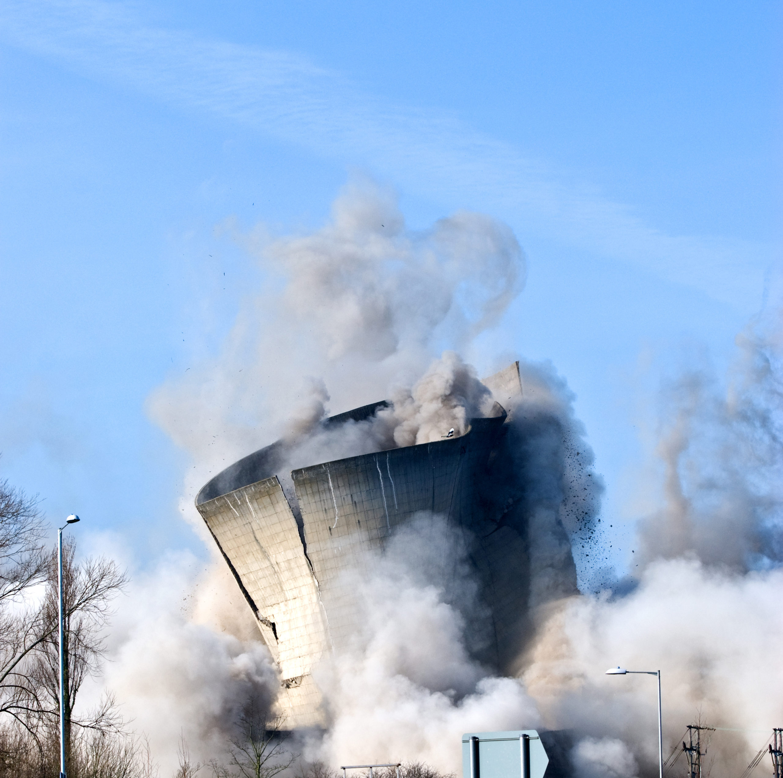
Near surface seismics assist engineers with better understanding the subsurface. Seismic equipment can either record ambient or passive vibrations. By deliberately sending energy through the ground the recorded response measures how the waves reflect, refract, and disperse through different materials. This information is then used to create a model of what lies beneath the surface. Additionally, by understanding how seismic waves travel through the ground, we can better interpret data. In this post, we will dive into some of the background information on near surface seismics that every engineer should know.
What is near surface seismics and why is it important for engineers to understand this process?
As the name suggests, near surface seismics is a shallow approach that uses seismic equipment, theory, and applications. This process is important for engineers to understand. This help with understanding the near surface conditions and even the seismic site class of an area. The seismic site class is important because it affects the design of buildings and other structures. Near surface seismics can be used to perform refraction, reflection, MASW (Multichannel Analysis of Surface Waves), and cross-hole seismic surveys. These surveys are used to map the shallow subsurface in 1-D, 2-D, or 3-D. Shear wave surveys are commonly performed using near surface seismic methods. Shear wave surveys are often used to map shallow subsurface features in high-velocity materials. Borehole seismic surveys are a type of near surface seismic method. Borehole seismics assist with determing propagation velocities across subsurface layers using boreholes.
The different types of waves that are generated during a seismic survey
Seismic surveys are an important tool in a variety of industries. They allow us to observe and record the properties of the Earth’s subsurface. Understanding different types of seismic waves that are generated is key to determining what’s happening below. P-waves (Primary) are longitudinal compressional waves that travel through rocks at a higher speed than S-waves. P-waves can also experience refraction and reflection within the Earth. While P-waves are commonly refered to as primary waves, S-waves denote shear or secondary waves.
S-waves, on the other hand, are transverse waves with vertical particle movement. The oscillations are perpendicular to the direction of the wave’s propagation. S-waves also travel more slowly than P-waves. S-waves are often used to determine Poisson’s ratio and shear modulus. Rayleigh waves and ground roll occur during most seismic surveys; Rayleigh waves move along the surface of the ground in an oscillating elliptical motion. The dispersion properties of ground roll or Rayleigh waves is the basis for MASW applications.
How to interpret the data collected from a near surface seismic survey
Interpreting the data gathered from a near surface seismic survey requires skill and experience. For refraction methods, first breaks are a key element in this technique. They allow for the determination of depths of underlying strata and can reveal P-wave velocities of soils and rock. P-Wave reflections are commonly used to define lithological units and evaluate the area’s geological structure. Reflection surveys offer much greater depths of investigation than refraction or MASW methods. Studying and interpreting Rayleigh wave dispersion images from an MASW survey allows for more in-depth analysis of the geological or man-made features of interest. With experience and good analysis techniques, interpreting the data collected from near surface seismic surveys yields valuable insights into the geology, environment, and man-made conditions.
Applications of near surface seismics in engineering projects
Near surface seismics are widely used in engineering projects to estimate soil thickness. Thus, one can measure the depth to the top of bedrock. Survey methods include reflection, refraction, or dispersion techniques. These types of seismic techniques are exceptional when mapping faults, bedrock units, and measuring the stiffness of soils. Seismic method’s ability to estimate the physical properties of subsurface materials is often understated.
The equipment used in near surface seismics and how it works
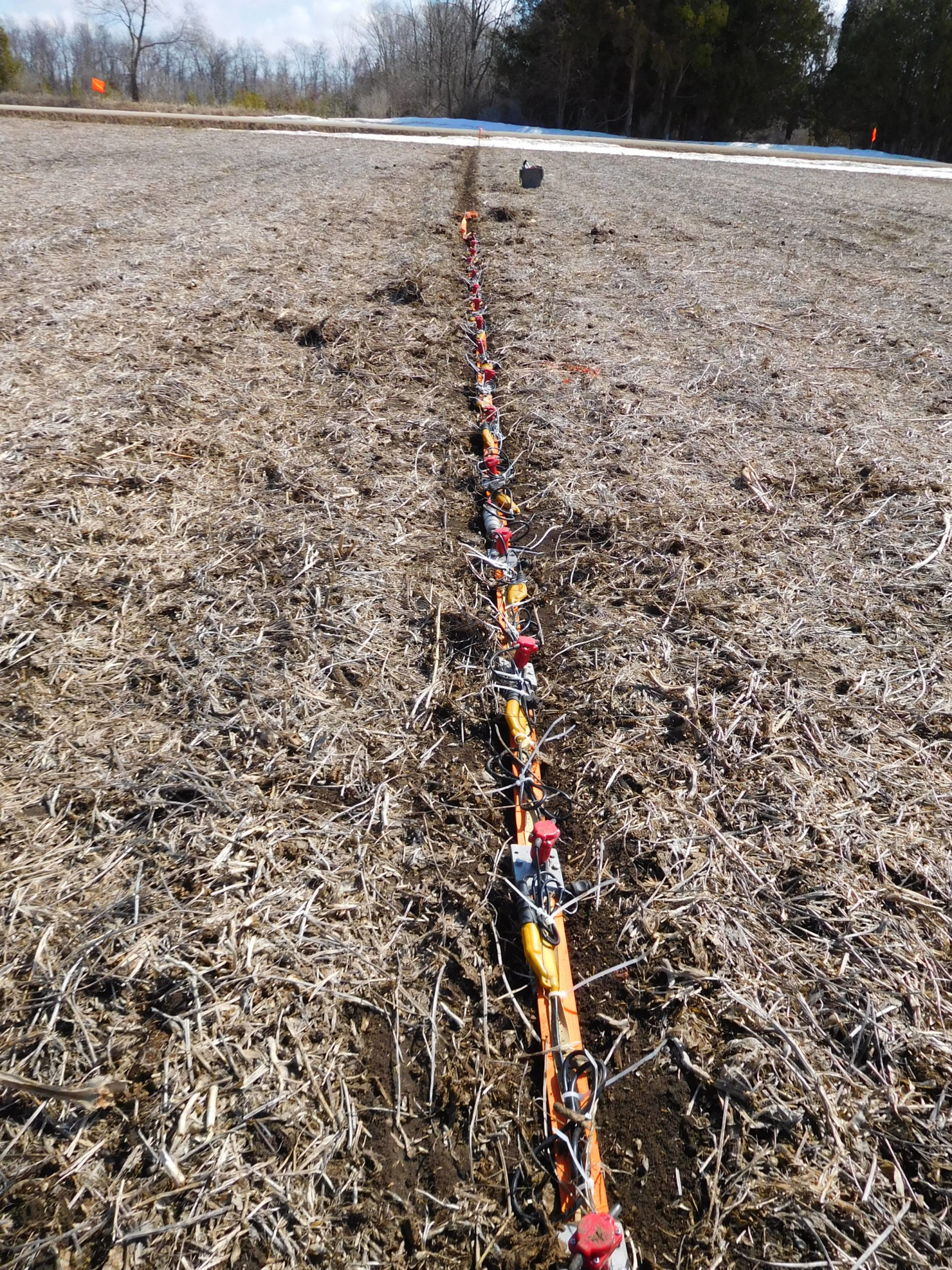
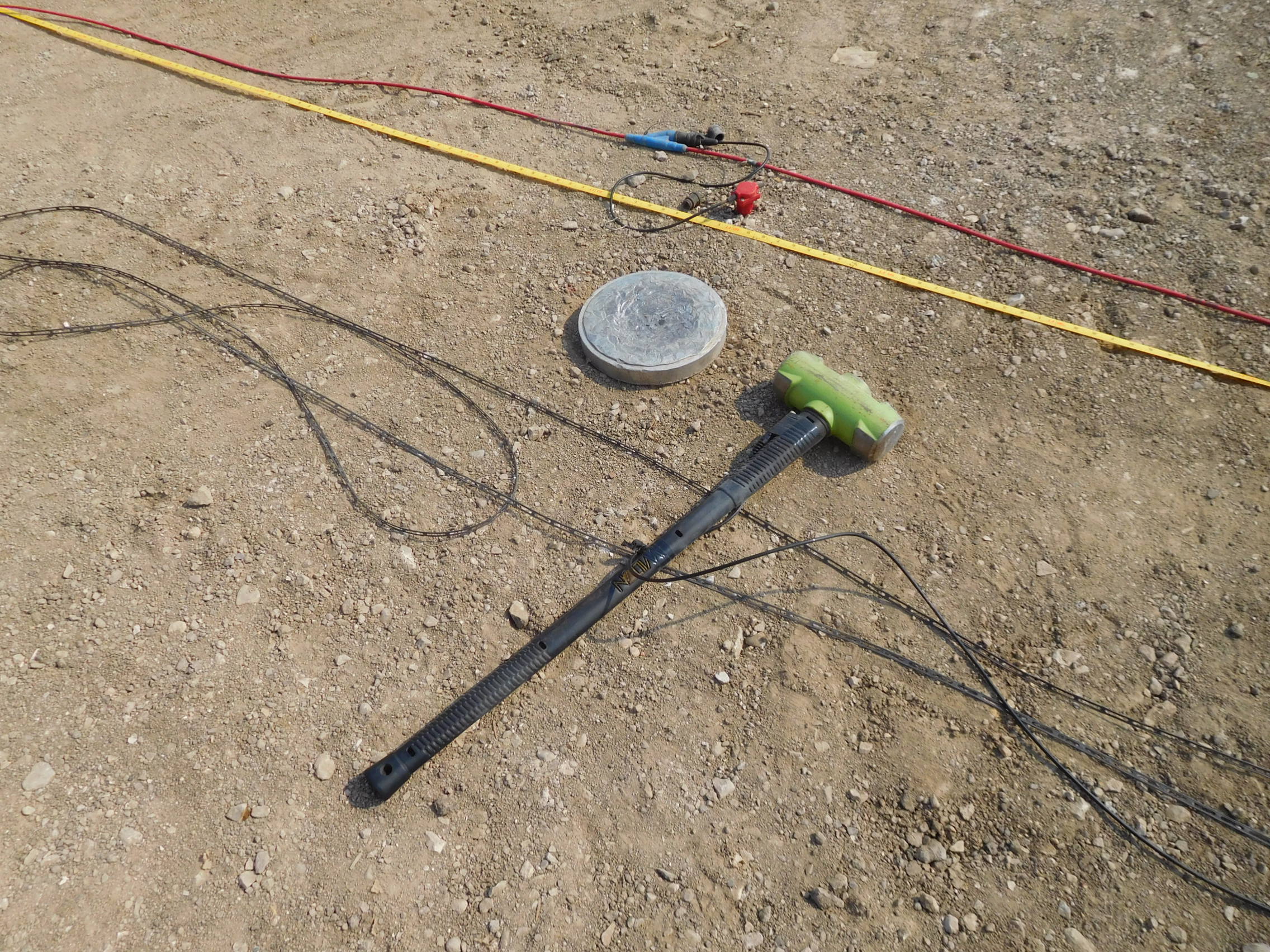
The seismic equipment used in near surface seismics consists of seismographs, geophones, hammer sources, elastic wave generators (EWG), and cables. Seismographs record the measured refracted, reflected, and propagated seismic energy sent by the source. Geophones placed on the surface can detect vibration caused by a source. Active sources include sledgehammer, EWG, vibrator, explosion, pile driver. Energy from traffic, trains, and wind are generally considered passive sources. Borehole geophones are used to measure subsurface vibrations created by an impulsive source such as a Ballard Source. Seismic sources generate a variety of wave forms that interact with soils, rocks, and other geological features. This allows scientists to gain insight into the deeper structures of the Earth’s surface.
By analyzing the amplitude, frequency, and timing of these waves, it is possible to obtain information about subsurface properties, including the type and thickness of sediments or rocks beneath the surface. This data can be used in a range of engineering applications.
Borehole seismics gather information on subsurface geological structures and characteristics, such as stratigraphic and structural data. These methods rely on the use of seismic energy produced by active sources at the surface or within a borehole. The generated waves propagate through the medium and are then recorded by receivers. Th located at different depths in the borehole. The recorded signals are processed to give an interpretation of physical properties. Properties include compressional wave velocities, shear wave velocities, density, porosity, saturation profiles, and lithology. This method is extremely useful because it provides high-resolution data that can be applied to a variety of subsurface engineering studies. Thus far, there have been numerous applications of borehole seismic methods that demonstrate their usefulness in various subsurface investigations.
Ground vibration monitors
Ground vibration monitoring is an important part of controlling environmental effects from blasting, pile driving, and railroads. Through it, specialists can accurately measure and evaluate ground vibration levels during high-intensity activities and make sure that these activities are within acceptable limits. The process involves setting up geophones and accelerometers around the area of activity, which record the vibrations created by the activities in a continuous stream. This data is then analyzed to determine whether or not the activity is creating excessive ground vibration levels. The collected data can also be used to create accurate models of ground vibration behavior.
Ground vibration monitoring helps ensure that conditions are safe for workers, nearby residents, and the environment. Understanding of how vibrations travel through different types of soils allows construction sites to adjust their processes as needed. Ground vibration monitoring can indicate areas where extra caution may be needed due to existing problems like unstable soils or buried utilities.
Find Pages On EngineeringGeophysics.com
Seismographs, Geophones, Cables, Seismic Sources, and Land Streamers
Geophysical equipment manufacturers are some of the most important players in engineering seismics. There are a number of companies that specialize in this field, all bringing unique products and services to the table. Geometrics’ Geode seismograph is one of the most popular choices for its high quality and reliable performance. RT Clark offers a variety of geophones with different cases and connectors. Pro-Seismic Services specializes in manufacturing seismic and electrical resistivity cables. For land streamer designs, Geophysical Equipment Rental LLC and Geostuff are renowned for their superior designs. A wide variety of sledgehammers, vibratory hammers, and weight drops are available. Many different manufacturers are available to meet the needs of any consumer.
Without doubt, some provide training on their equipment. They may also provide other resources such as technical advice or repair services. These manufacturers have become an essential part of successfully conducting any seismic survey project.
Geometrics’ Geode
Geometrics’ Geode seismograph is the most versatile and flexible seismic instrument on the market. It’s small enough to fit into a suitcase and expandable for full-scale 2D and 3D surveys. With its rugged construction, it can withstand extreme temperatures, shocks, dust, and even submersion. It is incredibly easy to use. Simply hook up your laptop and run SeisImager software for viewing, recording, or processing your data. You are also able to connect multiple Geode units together for building systems of up to 1,000 channels. This device is ideal for reflection, refraction surveys, MASW testing, tomography studies, equipment monitoring, marine profiling, continuous recording – even earthquake or quarry blast monitoring! The Geode comes with a generous 3-year warranty from the manufacturer so you can be sure that you’ll be getting value out of this durable unit for years to come.
RT Clark offers a variety of geophones and GPEG sources for Engineering Seismics
The R.T. Clark Companies, Inc. is a thriving business. They provide a wide range of professional services to its geophysical, geotechnical, engineering, and environmental communities. Established in 1983, the company has earned a reputation as an industry leader. Their innovative products, include the Gravity Propelled Energy Generator (GPEG) and Ballard Borehole Seismic Source. Both have been designed to meet the highest standards of accuracy and performance. Their GPEG system brings together simple mechanics and advanced electronics for a reliable seismic energy source. It can generate 180,000lbs of Peak Force at 5,629 Joules of Kinetic Energy from 500kg mass drop system. The Ballard Borehole Seismic Source allows engineers to conduct highly accurate P-wave and S-wave cross-hole tests. The systems meet ASTM standards quickly and efficiently; saving time and money by streamlining the process.
R.T Clark Companies’ are dedicated to excellence in customer service with top-of-the-line technology. They continue to develop new technologies while maintaining an exemplary record in customer satisfaction. Their team of experts are committed to staying abreast of any changes or advancements in technology. They offer reliable solutions tailored to every client’s unique requirements, which leads to success.
Pro-Seismics Services
Pro-Seismic Services is a leading provider of various specialized cables and connectors for seismic technology. They also specialize in resistivity, refraction, land, and hydrophone cables as well as geophone assemblies. Pro-Seismic Services provides some of the highest quality products for our customers. Their experienced team offers custom modifications and specialized molding to meet the specific design needs of each client. At Pro-Seismic Services they are committed to providing excellent customer service. All work comes with a lifetime warranty. They take pride in having immediate availability on most products. This leads to quick solutions for the clients’ cable and connector needs. The expert staff is ready to assist you with any questions you may have! With years of experience working in this field, Pro-Seismic Services looks forward to meeting your seismic technology needs with quality products and top-notch customer service.
Geophysical Equipment Rental LLC and Geostuff
Geophysical Equipment Rental LLC
is an industry-leading provider of geophysical services and equipment (e.g. land streamers). Founded by a veteran in the industry, with over three decades of experience. The company specializes in providing reliable solutions for EPA investigations, real estate transactions, groundwater studies, underground storage tanks, power and transmission line facilities, mining, agriculture, and private cable, pipe, and facility locating. Geophysical Equipment Rental LLC offers customers exclusive access to experienced personnel. They provide a range of services from renting out specialized equipment to performing limited repairs and troubleshooting problems. Training is avalable on how to use the equipment. This way customers can get the most out of it when they rent or purchase.
Land streamers, with their unique design, are able to provide superior data coverage compared to conventional geophone arrays. Land streamers also have the capacity for high-speed data acquisition with multi-channel survey capabilities and near instantaneous response time, allowing for very rapid completion of surveys. The result is fast mapping and great accuracy without sacrificing image resolution. Additionally, a land streamers’ portability allows them to be used in a variety of environments. This makes them an invaluable tool in many seismic surveying projects. Our commitment to quality customer service and excellent products has allowed us to become one of the leading suppliers of geophysical services and equipment in the area.
Geostuff Land Streamers
are at the forefront of seismic surveying technology, offering a combination of high-quality data and increased productivity. Geostuff land streamers offer a versatile solution that is both cost-effective and reliable. Unlike the Geophysical Equipment Rental’s smooth base, Geostuff’s land streamer has three pads, like a tripod.
In addition to their land streamer, Geostuff designs borehole geophones. The basic Model BHG-2 is a state-of-the-art wall-lock borehole geophone. It can fit inside a 2’ plastic pipe for easy installation. The clamping mechanism uses a DC electric motor with a steel spring that provides robust operation and reliability, and its hardy design can handle depths of up to 500 meters (depending on conditions). The standard geophones boast high output and superior 15 Hz natural frequency. Other natural frequencies such as 10, 14, 28 or 40 Hz are available. The BHG-3 model features a fluxgate compass and servo motor system to automatically rotate the horizontal geophones to your desired azimuth angle. This allows you to accurately fine tune your measurements while avoiding manual labor in the process. Overall, Geostuff’s wall-lock borehole geophones provide reliable data collection at remarkable depth capacity.
Instantel Ground Vibration Monitors
Instantel ground vibration monitors are an advanced technology that helps to protect buildings and infrastructure from potentially damaging vibrations. These powerful monitoring systems measure and log groundborne vibration from sources such as blasting, construction, demolition, and quarrying operations. With Instantel’s Minimate, Micromate and Blastmate products, users can accurately monitor the impact of vibration on structures in real-time and for long-term analysis. The monitoring system is designed to detect even low-level impacts that may otherwise go unnoticed.
By measuring the peak particle velocity (PPV) of each vibration event with high sensitivity, Instantel systems provide detailed information about PGA levels and other important metrics to ensure construction activities remain safe for workers, buildings and nearby communities. The data gathered by these monitors is invaluable for maintaining safety standards in construction sites across the world. Additionally, the Minimate and Micromate models feature advanced onboard memory so users can store large amounts of data without having to constantly monitor their equipment or connect it to a PC or laptop. This makes it more efficient than ever before to track multiple parameters in various locations at once. With its reliable performance and intuitive design features, Instantel ground vibration monitors offer an effective solution for protecting structures from potential threats while ensuring all safety regulations are met with accuracy and precision.
Sledge Hammers for Seismics
The Wilton B.A.S.H sledgehammer is the crown jewel of our Unbreakable® Handle Technology, the first of its kind in the professional tools industry. Their patented design features a longer handle for greater leverage and power for hard materials, an ergonomic no-slip rubber grip that prevents strain on your hands, as well as a reinforced metal core with a protective steel sleeve to protect from damage and wear over time. With all these features combined, it’s no wonder why this tool is renowned for its strength and durability – so much so they offer a $1,000 guarantee (see Wilton for details) if you can find anything better. The Wilton B.A.S.H sledgehammer is perfect seismics. Their sledgehammers provide reliable results every time!
Conclusion
Near surface seismics is a process that uses ground vibrations or waves to image the subsurface. This information is useful for engineers working on various types of projects. The equipment used during a seismic survey measures different types of waves, which are then interpreted to create a picture of what is beneath the ground. Engineering seismics have many applications and solve problems related to geology, hydrogeology, environmental studies, buried private facilities, and even archaeology. Do you have an engineering project that could benefit from near surface seismic surveying?