Geonics Instruments’ EM31, EM34, EM38, and EM61 geophysical equipment are powerful tools for engineers. These instruments characterize conditions at depth over spatially large areas. With the right tools and knowledge, these instruments map geological features and structures, detect buried metal objects, discover potential hazards at construction sites, and more. Compared to traditional surveying methods, these instruments provide reliable results without intrusive excavation work. With Geonics Instruments’ geophysical equipment, engineers can quickly and accurately obtain data for their projects, saving both time and money. Geonics Instruments’ geophysical equipment is the perfect choice for any professional engineering project.
How Geonics Instruments Can Help Engineers with Their Tasks
Geonics Instruments’ equipment is designed to make life easier for engineers. They allow them to get their job done quickly and accurately. The user-friendly controls on the equipment make it easy for engineers to obtain the data. They spend less time and effort scanning large areas. The instruments are lightweight and portable, making them convenient for onsite use or transportation between locations. Furthermore, using Geonics Instruments’ is cost-effective in comparison to traditional methods of data acquisition. This makes EM31, EM34, EM38, and EM61s invaluable equipment for engineers seeking reliable and prompt results. With Geonics Instruments’ geophysical equipment, engineers assess given areas more efficiently than ever before.
Measuring Geological Features and Structures with Geophysical Equipment
Geonics Instruments’ geophysical equipment has a wide variety of uses in measuring geological features and structures. Not only are they capable of detecting underground water, but also of providing insights into the composition and structure of underlying rock, soil and sediment layers. The instruments offer detailed readings. Interpretations help identify subsurface faults and fractures, as well as distinguish between different types of soils. In some cases, they can detect even the smallest changes in the subsurface. By monitoring over a long period of time one may observe the migration of contaminates. This makes them invaluable for locating preferential paths for fluids to flow. With these instruments, it is possible to detect objects that would otherwise be too small to locate by drilling. For example, the time and money necessary for closely spaced boreholes to find a karst feature can take up valuable resources while still providing no guarantee of success.
Detecting Buried Metal Objects with the Right Tools
Geonics Instruments’ geophysical equipment does more than just measure geological features and structures. Their advanced technology uses electromagnetic (EM) emissions to measure variations in electromagnetic responses over large areas. They can also detect buried metal objects, such as pipelines, cables, utility lines, underground storage tanks (UST), and even municipal fill. With the help of Geonics Instruments’ geophysical equipment, engineers can detect these objects. Often with relatively high precision and accuracy in a short amount of time. Unlike drilling randomly placed boreholes to explore a site, you can significantly reduce the risk of running into costly unexpected buried objects using geophysical instruments. For example, the time and money necessary for closely spaced boreholes to find an underground storage tank or UST can take up valuable resources while still providing no guarantee of success.
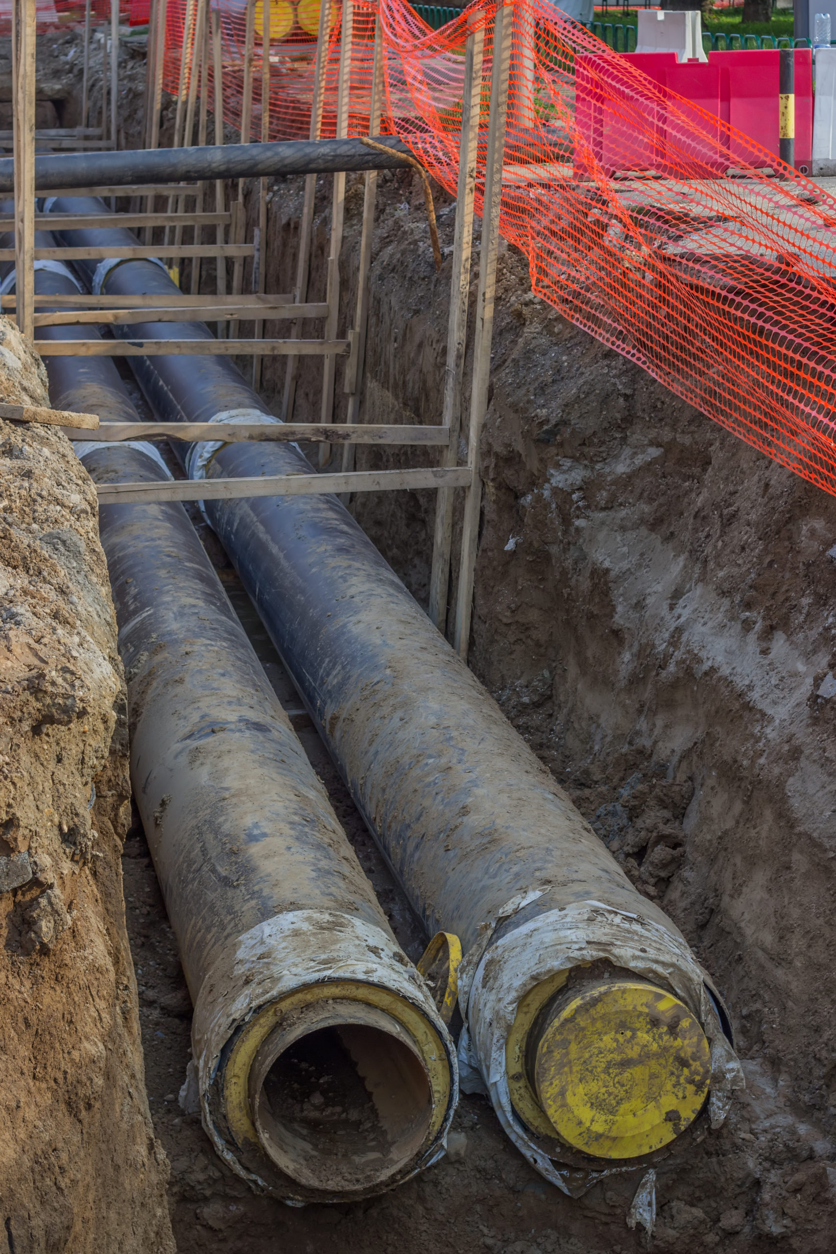
When the EM response is detected by the instrument, it is converted into a digital format. This format can then create 2-D plan view images. Plan view maps offer great detail on the location of buried metal objects or other zones of interest. In addition, their systems integrate GPS coordinates for relocating areas of concern, which further reduces field time for professionals. All these features make Geonics Instruments’ geophysical equipment invaluable for the reliable and efficient detection of buried metal objects.
Identifying Potential Hazards Near Construction Sites
Geonics Instruments’ geophysical equipment is an important tool for engineers working on construction projects. Instruments can provide information about the landscape and infrastructure around the site. Under the right conditions, the instruments can map underground anomalies caused by sinkholes, buried foundations, large storm drains, and unexpected construction or municipal fill. Measuring the size of an anomaly helps engineers assess potential hazards at a construction site. In addition, detection can reveal hidden dangers that may not be visible to the naked eye. With EM31, EM34, EM38, and EM61’s ability to acquire site-specific data about potential hazards promptly, Geonics Instruments help ensure that a project is completed with safety in mind.
Find Pages On EngineeringGeophysics.com
Types of Geonics equipment
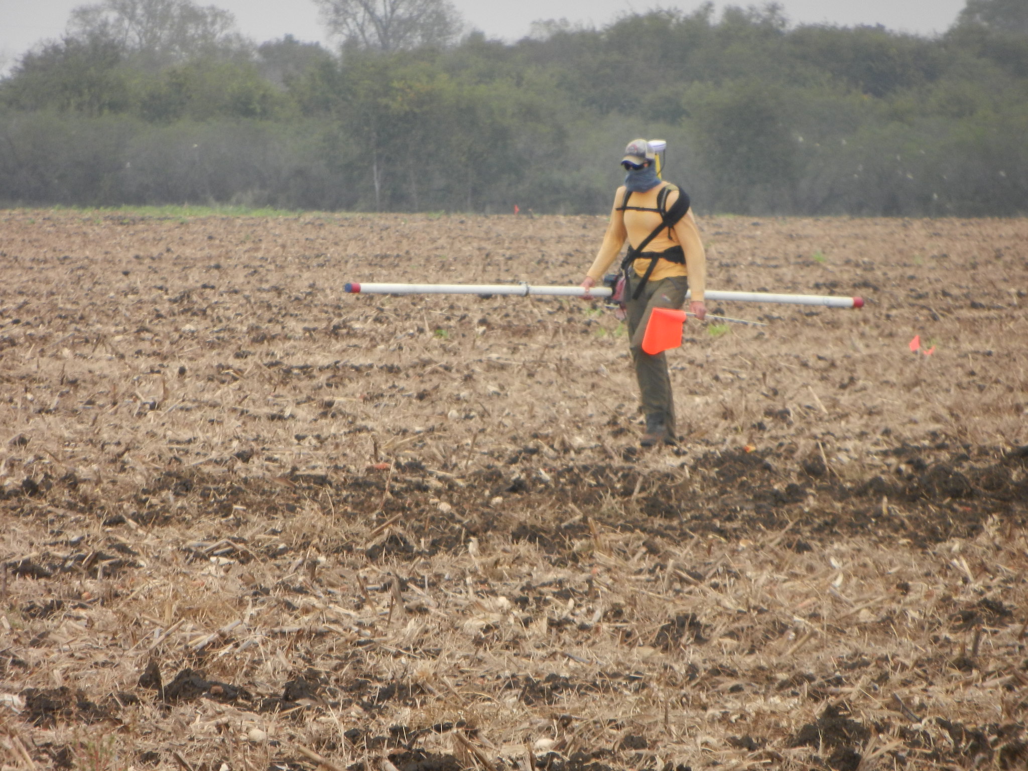
Geonics offers EM31, EM34, EM38, and EM61s. While the EM61 is a time-domain electromagnetic instrument or TDEM device designed specifically for metal detection, the other three units are electromagnetic terrain conductivity meters. These patented instruments measure apparent conductivity and are designed to scan large areas quickly and accurately.
Geonics EM31, EM34, and EM38 electromagnetic terrain conductivity meters
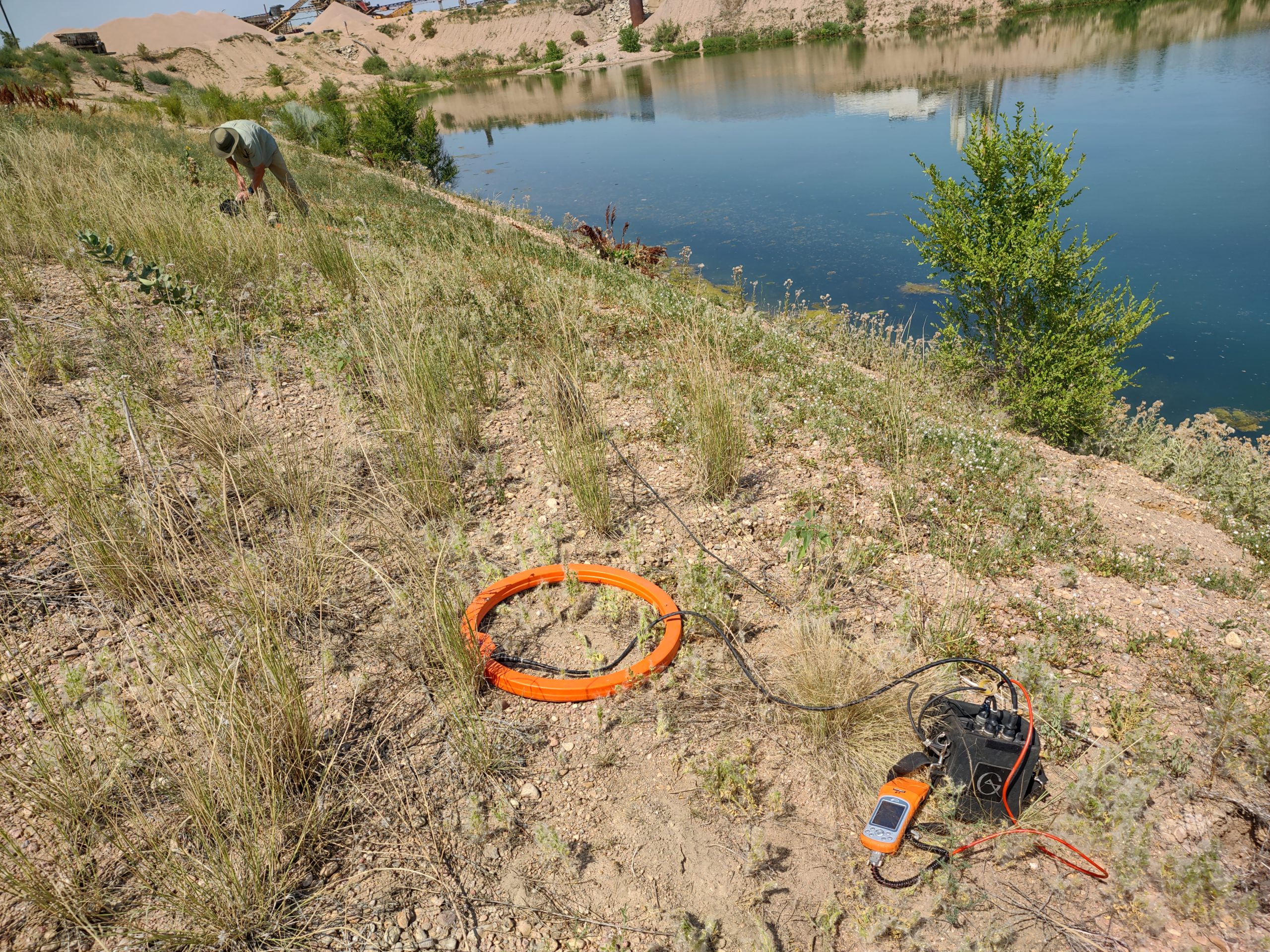
Ground conductivity meters are powerful tools for measuring subsurface conductivity and magnetic susceptibility. These meters do it without any need for direct contact between the instrument and the soil. The main advantage of this non-invasive method is its ability to quickly collect closely spaced data. Closely spaced data provides better spatial resolution over a range of geologic environments. This includes areas with materials with sand, gravel, and clay-rich soils. Furthermore, ground conductivity meters boast a robust design that can easily withstand harsh weather and environmental conditions while gathering reliable data in remote locations. As a result, they are often used by experts in several fields including geophysics, civil engineering, hydrology, archaeology, and mineral exploration.
Above all, their readings can be integrated with other datasets. Integrating GPR, magnetics, seismic, or electrical resistivity methods can provide meaningful insight in a study. Since these instruments have low power requirements they are very portable. Without doubt, they are easier to carry than many other geophysical instruments.
When comparing EM34, EM31, and EM38 instruments
the EM34 offers one of the greatest advantages in terms of depth penetration. With its two coils connected by a cable, it can be configured for depths of about 25ft, 50ft, 100ft, and 200ft. The EM38 instrument focuses on shallow conditions, up to approximately 5ft. In comparison to the EM34, the EM38 is better suited for conditions as shallow as 1 ½ft. Meanwhile, an EM31 and an EM31 short are optimized for depths between about 5 and 20ft. All four instruments measure the inphase response which can be useful for locating buried metal. To be sure, it’s important to note that they all function best when used within their specific depth range. The EM38 will not penetrate deeper than about 5ft. It is not suitable for greater depths. In constast, the EM34 is unlikely a good choice for depths less than 25 feet.
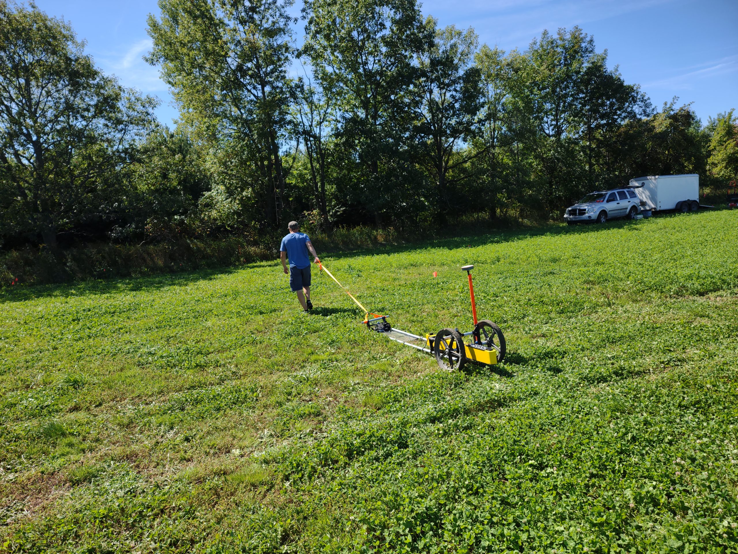
The EM38-4 and EM31-8 instruments
from Geonics are the latest developments in apparent conductivity measurement. The EM38-4 offers a range of shallow measurements, from 1.5ft to 5ft, utilizing four sets of coils for data collection. This advanced design is capable of covering vast areas with ease. Like the EM31-8, it can be used with a sled or cart for faster data acquisition.
The EM31-8 offers eight sets of coils that measure apparent conductivities between 5ft to 18ft. Such versatility allows scientists and engineers to acquire greater amounts of apparent conductivity data. Both new models are incredibly easy to set up and operate. This makes them ideal for any user regardless of their technical knowledge or experience level. Furthermore, their additional coils detect even more minute changes at varying depths which provides further insight into subsurface composition and structure. As such, these innovative instruments are sure to revolutionize how apparent conductivity is measured in the future.
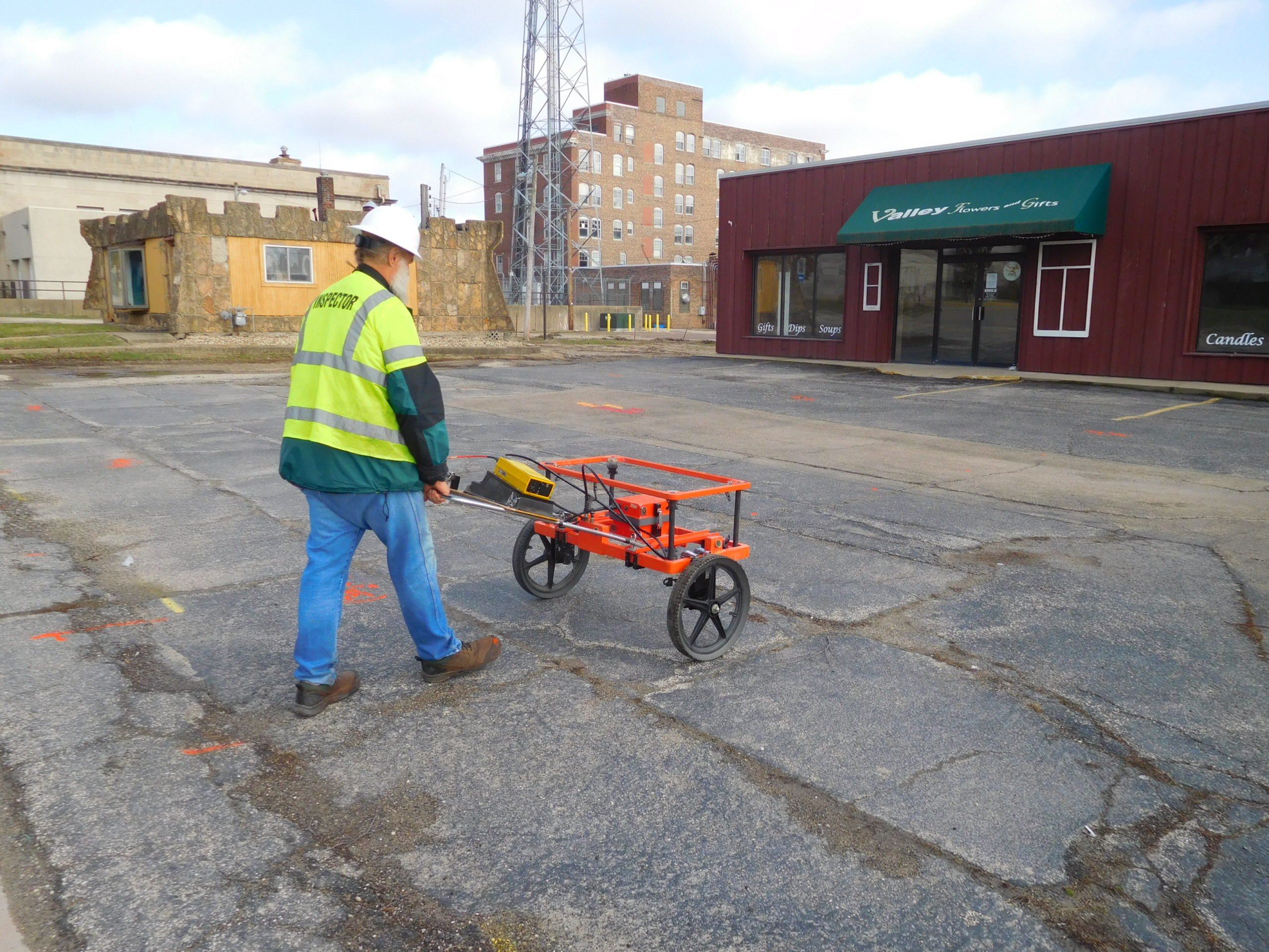
Geonics EM61 electromagnetic metal detector
The Geonics EM61 metal detector is a state-of-the-art device that offers unparalleled sensitivity and accuracy. It boasts a wide dynamic range, providing increased detection capabilities in even the most challenging survey environments. Additionally, its advanced features reduce false readings, ensuring results of the highest accuracy and reliability. This makes it an ideal tool for professionals searching for buried drums, mapping construction or municipal waste, locating underground storage tanks (UST), tracking utility cables and pipes, detecting infrastructure, and finding unexploded ordnance. The EM61 stands out among other metal detectors due to its superior sensitivity, superior target discrimination capabilities, and ease of use. It is extremely portable and can be easily transported from one site to another. With the EM61, professionals can trust they are receiving reliable data with impressive accuracy at all times – making it an invaluable tool for any job.
The battle-hardened Geonics EM61-MK2A is a powerful and reliable tool used by environmental and military professionals to detect and classify different types of metallic objects in the ground. This technology allows users to determine the depth of detection (up to 5.5m) depending on target characteristics, as well as record both EM and GPS data for precise localization. The upgraded EM61S model has been specifically modified to work in marine environments submerged or above water. The more highly portable smaller EM61HH-MK2 (Hand-Held) provides even higher sensitivity for smaller targets at shallow depths, resulting in better rejection of cultural noise and improved accuracy of results. Last, the EM63-3D-MK2 can measure the full decay associated with metallic targets, making it possible to easily distinguish between them. For example, when searching for unexploded ordnance, this technology makes it easy to identify which objects should be avoided or explored further.
Save Time and Money with Geophysical Equipment
For decades, Geonics Instruments’ geophysical equipment has revolutionized the way engineers obtain site-specific data for their projects. By utilizing these powerful geophysical tools, professionals are able to identify and map underground features quickly, accurately, and cost-effectively. This technology can map variations in soil conductivity and detect concerns such as buried pipelines, cables, foundations, and sinkholes. Furthermore, the instrumentation is often vital for locating potential contamination, groundwater, archaeological concerns, and more. Geonics Instruments help engineers save time and money on their projects by minimizing manual searches or drilling geological features that might otherwise be necessary. As an added benefit, these instruments provide results that have been proven reliable in a variety of other industries. With the help of this innovative technology, engineers can trust in the accuracy of their data while staying on budget with their projects.
In conclusion, all of Geonics’ instruments are exceptionally easy to use and offer cost-effective solutions. The unprecedented capabilities of Geonics Instruments’ geophysical equipment offer a great solution for any professional engineering project. By utilizing their powerful tools and knowledge, engineers and others can measure geological features and structures with increased accuracy, identify potential hazards near construction sites, and detect buried metal objects in a fraction of the time it would take for more traditional methods. By investing in this type of equipment, engineers can be sure that they are making the best decisions for their projects. They will have reliable data at their fingertips and be able to confidently move forward with any engineering project. Return to EngineeringGeophysics.com home page.