Welcome to Engineering Geophysics .com! We are excited to offer our engineering geophysical services, surveys, and rentals to those in need. Our team, of experienced geophysicists, is here to provide you with the highest quality services possible. We hope that you take advantage of our assistance to help you with your next project! Thank you for choosing EngineeringGeophysics.com!
Engineering Geophysics is the application of geophysical methods to engineering problems
Clearly, engineering geophysics is an invaluable tool used to provide information on geology, construction, remediation, and groundwater engineering. Common applications involve landfill and Superfund site characterizations, site soil classification, imaging concrete scanning, ground vibration monitoring, construction hazard detection and avoidance, roadway design optimization, and embankment stability assessment. By utilizing advanced techniques such as electrical resistivity, seismic MASW/refraction/reflection, ground penetrating radar (GPR), magnetometers, line locators, ground vibration monitors, and electromagnetic surveys, engineering geophysicists can generate results with a reasonable degree of accuracy for construction analysis, remediation plans, and groundwater models. Geophysical methods can penetrate roadways or construction surfaces. This eliminates digging up the site or causing offensive damage. Thus, engineers can collect data quickly with little interruption from the construction process.
Geophysical services offered include surveys for geological, environmental, and engineering purposes
EngineeringGeophysics.com is the go-to source for all your geophysical needs, providing comprehensive services and solutions. Their team of experts delivers high-accuracy results with reliable equipment and surveys designed to meet any situation’s challenges. For example, ERI and MASW for environmental and geological surveys, GPR, EM, and line locators for metal detection or subsurface utility engineering, or concrete scanning for due diligence. EngineeringGeophysics.com has it!
For environmental or engineering purposes, their survey services come at an unbeatable price. With state-of-the-art technology and a team of experienced geophysicists supporting each project, you get the most accurate data in the least amount of time. Not only do they provide top-quality products but also offer expertise on how to use them effectively. EngineeringGeophysics.com assists from training sessions conducted by experts to ongoing customer support provided through phone or email. This site offers assistance from start to finish. So if you need reliable geophysical solutions with excellent results, look no further than EngineeringGeophysics.com!
WhatIsGeophysics.com.com – Your Gateway to the World of Geophysics
WhatIsGeophysics.com (currently under construction with limited services) provides an easy way for you to find links to dozens of geophysical websites, each specializing in a different area of near surface geophysical applications. Whether you are looking for rentals, services, training, or just some fun sites to explore, we have something for you! Our user friendly site makes it easy for you to find what you need and get started in the world of geophysics. Thanks for visiting!
Find Pages On EngineeringGeophysics.com
Engineering geophysics to assess environmental impacts, locate buried objects, or map the subsurface
Without doubt, geophysical surveys offer engineers an approach to gain insights into the properties of the underlying topography and help them determine site soil classification, locate groundwater sources, identify faults and fractures, map buried metal objects, detect post-tension cables or concrete thickness, and delineate contamination. Take advantage of the expert knowledge provided by experienced geophysicists. Geophysical surveys are available for a plethora of projects. For example, assessing environmental impacts, mapping subsurface features, and even locating unknown zones of interest.

Geophysics is an extremely comprehensive tool that is incredibly useful for a variety of tasks and applications. Whether you’re looking to build upon an existing structure or acquire an assessment of current conditions – surveys are essential if you need information on what lies beneath. Moreover, geophysical surveys have come a long way in recent years. Engineers will find significant advances in instrumentation and sophisticated computer software. These improvements give engineers even greater accuracy and detail in data acquisition.
Clearly, the data acquired by geophysical methods is also dependable because it is collected from physical measurements. In other words, measurements taken directly from in-situ conditions at a site. This means that one can feel confident about using this data for their project. On site results provide more reliable insights into various aspects of site investigation. Furthermore, surveys require very little time compared to traditional methods, like excavations. Thus, site evaluations are a quicker process. Engineers are better equipped with facts before any engineering project is undertaken.
Equipment rentals are available for a variety of geophysical methods, including seismic, electrical resistivity, electromagnetic terrain conductivity, magnetic, line locating, ground penetrating radar, borehole geophysics
If you have the experience, the company also offers rentals for all kinds of geophysical purposes that are suitable for various budgets – whether short-term or long-term. Customers can have equipment shipped overnight across the country. Furthermore, Engineering Geophysics provides equipment rentals for a wide range of geophysical methods such as seismic, electrical resistivity, electromagnetic terrain conductivity, ground penetrating radar, utility or line locating, and magnetometer surveys.
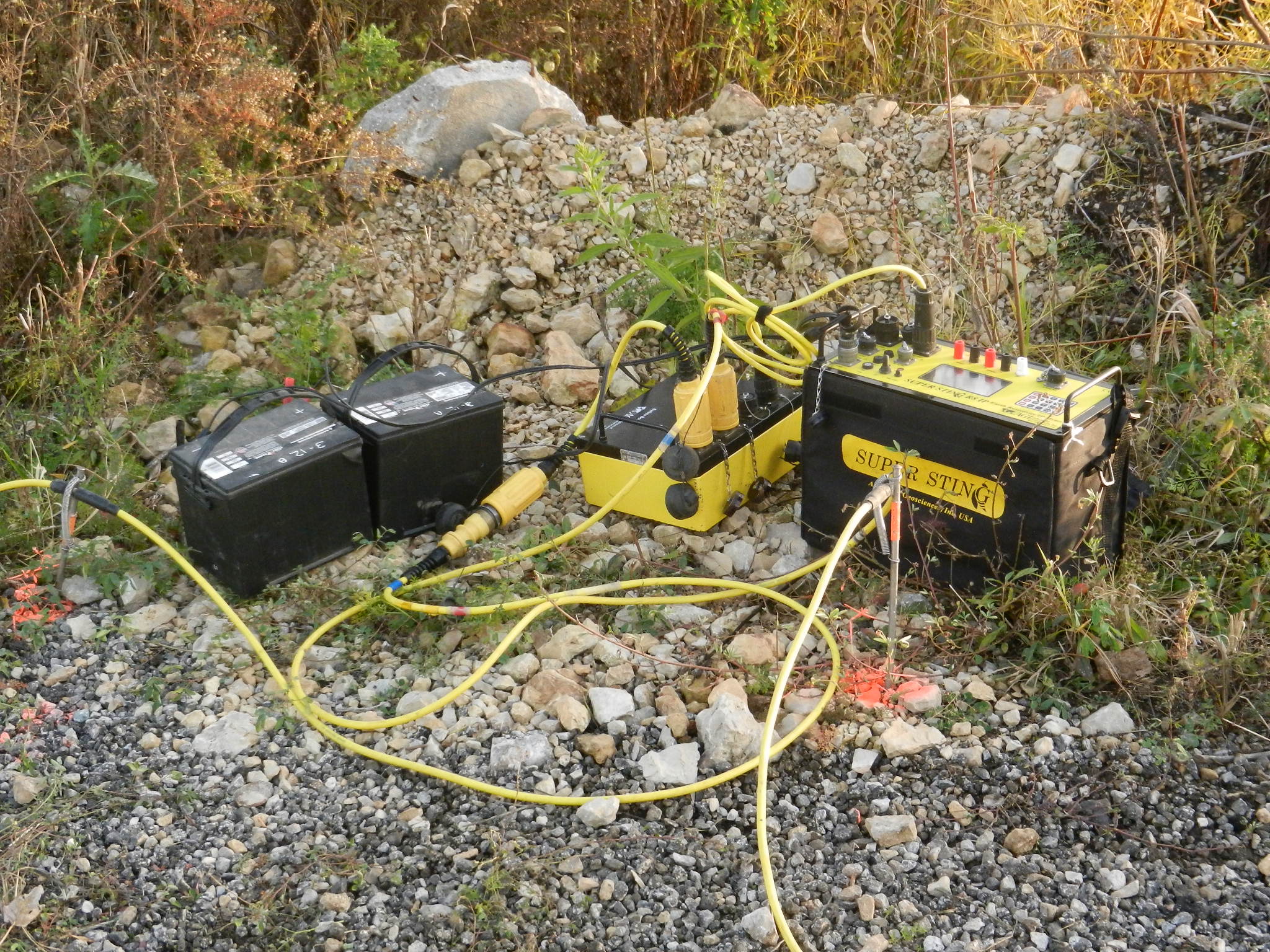
A Geometrics Geode seismograph is ideal for shallow seismic imaging or MASW surveys; an AGI Supersting R8 ERI system enables users to measure electrical resistance in two-dimensions using eight separate channels at the same time; Geonics produces a range of advanced electromagnetic equipment, namely the EM38, EM31, EM34 and EM61, which are engineered to measure and assess various subsurface conditions with high levels of accuracy; Geometrics G858 magnetometer can be used to measure variations in the earth’s total magnetic field; and Sensors & Software’s Noggin and pulseEKKO Ultra systems provide users with a comprehensive set of GPR solutions for an extensive array of engineering applications, ranging from relatively shallow surveys to deeper, more intricate, projects. With these tools available for rent, Engineerin geophysics provides comprehensive support to help you understand the subsurface structure more accurately.
Summary of Pages at EngineeringGeophysics.com – A Comprehensive Resource for Engineering Geophysics
If you’re looking for user-friendly information about engineering geophysics, then this blog post is perfect! We have detailed explanations and pages dedicated to electrical resistivity, seismic methods, ground penetrating radar, magnetometers, Geonics instruments, ground vibration monitors, line locators, and more – so be sure to check it out. With this knowledge, engineers can better evaluate potential projects and ensure the safety of both people and property.
Engineering geophysics and Electrical Resistivity Explained in Simple Terms
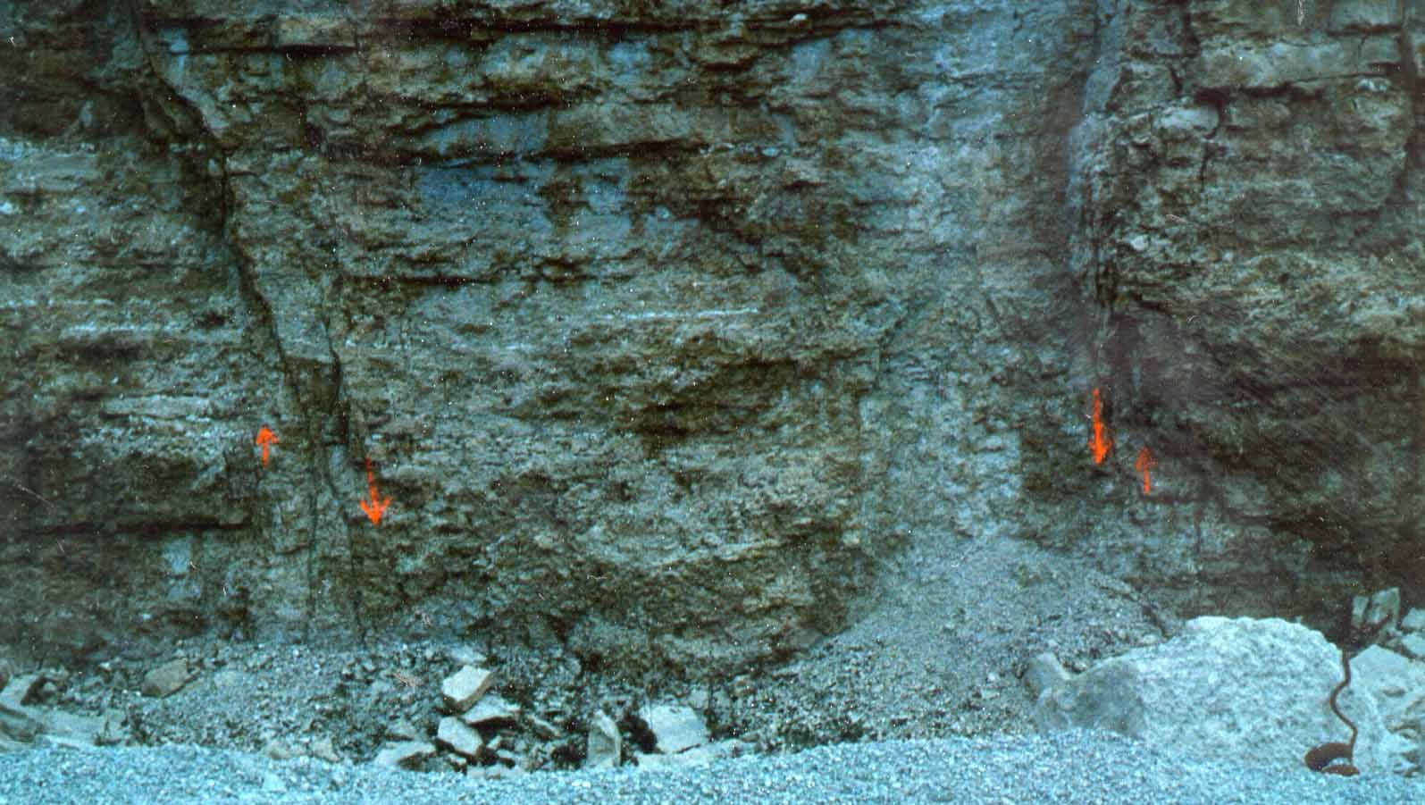
Electrical resistivity imaging and soundings are based on the measurements of how a material resists the flow of electricity. It has important applications, particularly for assessing subsurface features and understanding the geology, groundwater environment, contamination, and others. This method involves placing electrodes on the surface of the ground and running an electrical current through them. By measuring the resistance of the material, researchers can estimate the properties and composition of the subsurface environment. Follow this link to EngineeringGeophysics.com’s page on electrical resistivity methods.
Electrical resistivity soundings are essential for power station surveys, providing engineers with valuable information about the subsurface materials and helping them determine the suitability of potential sites. Two well-established methods for conducting electrical resistivity soundings are ASTM G57 and IEEE 83. Subsequently, ASTM G57 is a four-electrode field testing method that measures subsurface resistivity values in sites areas while IEEE 83 involves measurements made with a various number of electrodes in an array to measure larger subsurface areas. The data collected from these surveys assist engineers with the selection of suitable locations for constructing power stations. Electrical resistivity soundings are an important part of any power station survey. The can make all the difference in its successful completion.
Seismics for Understanding the Earth’s Structure and Composition
Seismic methods are used to investigate the structure and composition of the earth’s interior. Consequently, seismic surveys involve generating seismic waves from an energy source, such as a sledgehammer, ground vibrator, or an air gun, and measuring their refractions, reflections, and dispersive nature from subsurface layers. These waves are then analyzed and interpreted to gain insight into the conditions at depth. There are several seismic methods, including MASW, refraction, and reflection methods. In contrast, ground vibration monitors are specialized seismic recorders for vibration analysis. With their help, the intensity of ground vibrations or particle displacement caused by nearby activities such as blasting, pile driving, and vibratory compactors can be gauged. By utilizing these monitors, engineers can proactively recognize hazardous conditions before they arise. Follow this link to EngineeringGeophysics.com’s page on seismic methods.
Borehole seismic methods are an invaluable tool for providing high-resolution data to inform a range of subsurface engineering studies. These methods use acoustic waves which are generated at the surface or within a borehole, then propagate through the medium before being detected and recorded by receivers located at different depths in the borehole. In addition, the signals can be processed to provide useful information about the physical properties of the subsurface, including compressional wave velocities, shear wave velocities, density, porosity, saturation profiles and lithology. This data is crucial for developing more accurate and detailed models of geological structures and characteristics under the surface.
Ground Penetrating Radar (GPR) – What Is It Used For and How Does It Work
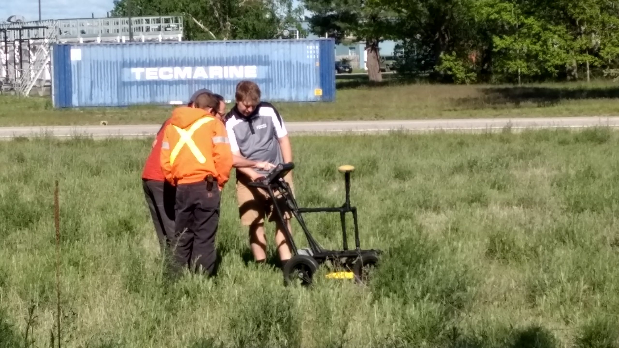
Ground penetrating radar (GPR) is a geophysical method used to detect subsurface features. This technology uses electromagnetic pulses to create images of the subsurface environment. For instance, GPR has numerous applications, such as locating underground utilities, assessing foundation integrity, locating reinforcing material in concrete, mapping soil compaction, locating voids, and more. Follow this link to EngineeringGeophysics.com’s page on GPR.
Magnetometers – Measuring Magnetic Fields of the Earth
For engineering purposes, magnetometers are often used to measure the strength of the earth’s magnetic field. An interpretation commonly provides insight into the location of buried ferrous metal. This method is used to identify buried objects, such as steel pipes, wells, drums, and underground storage tanks. Follow this link to EngineeringGeophysics.com’s page on Magnetometers.
Geonics Instruments – Using Electromagnetic Technology to Map Subsurface Structures
Geonics instruments are specialized tools used to measure the electrical conductivity of subsurface materials. This technique is regularly utilized in geologic and soil mapping, environmental assessments, locating buried metal, archeology studies, and mineral prospecting. Geonics instruments provide detailed information about the subsurface environment that can be used to evaluate potential risks to the environment. Follow this link to EngineeringGeophysics.com’s page on Geonics Instruments.
Line Locators – Finding Underground Utilities Quickly & Accurately
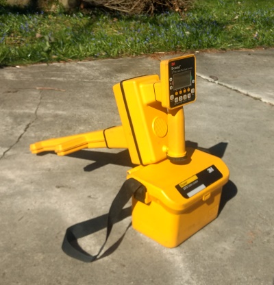
Line locators are specialized tools used to identify and map underground utilities. This method uses transmitter and receiver coils to detect electrical currents associated with pipes, cables, and other subsurface features. Line locator technology is an important tool for construction, engineering, and environmental management. Follow this link to EngineeringGeophysics.com’s page on line locating.
Why Choose Engineering Geophysics for Your Research Needs
EngineeringGeophysics.com is a comprehensive resource for all things related to engineering geophysics. Our site provides users with an overview of various methods and their applications in engineering projects. Whether you’re a student looking to learn more about engineering geophysics or a professional looking for resources to improve your work, EngineeringGeophysics.com is the perfect destination for all your research needs.
Thank you for visiting our site.
In conclusion, engineering geophysics is an invaluable tool for understanding the underground environment. With specialized instruments such as electrical resistivity, seismic methods, ground penetrating radar, magnetometers, Geonics instruments, ground vibration monitors and line locators, engineers can make informed decisions about potential projects. As such, it is essential for all engineers to have a thorough understanding of engineering geophysics.
Final comments
By no means should this website ever be used instead of user manuals, experience, or the knowledge necessary to successfully execute geophysical surveys. My background as a licensed professional geologist/geophysicist who has conducted more than 1000 surveys since 1985 confirms that one must possess an understanding in physics, mathematics, engineering and other sciences to gain maximum success from this type of survey. Other disciplines (Θ see below) utilizing engineering geophysics and geophysical applications are discussed. Some disciplines include frac sand exploration, archaeological geophysics, mine planning, levee certification, design, and mapping, geophysical classifieds, geophysical equipment sales, geophysical proposals, and geophysical training. Each link offers a blog about the primary geophysical method of the site. People are welcome to add comments to the blogs. More enthusiastic persons can request to write for their favorite blog.
Θ – Note all topics and sites of the geophysical network are not yet installed. Requests for areas of expertise are welcome.